|
Green Infrastructure is defined in the Water Infrastructure Improvement Act as “the range of measures that use plant or soil systems, permeable pavement or other permeable surfaces or substrates, stormwater harvest and reuse, or landscaping to store, infiltrate, or evapotranspirate stormwater and reduce flows to sewer systems or to surface waters.” Examples of some local green infrastructure include rain barrels or gardens, designating areas as open space, and bioswales. Most stormwater management materials used in development are considered “grey infrastructure” which includes pipes, culverts, tunnels, and more. These engineered systems regulate our watershed drainage and will likely never be phased out; however, many developers are now supplementing the grey with the green for a variety of reasons. 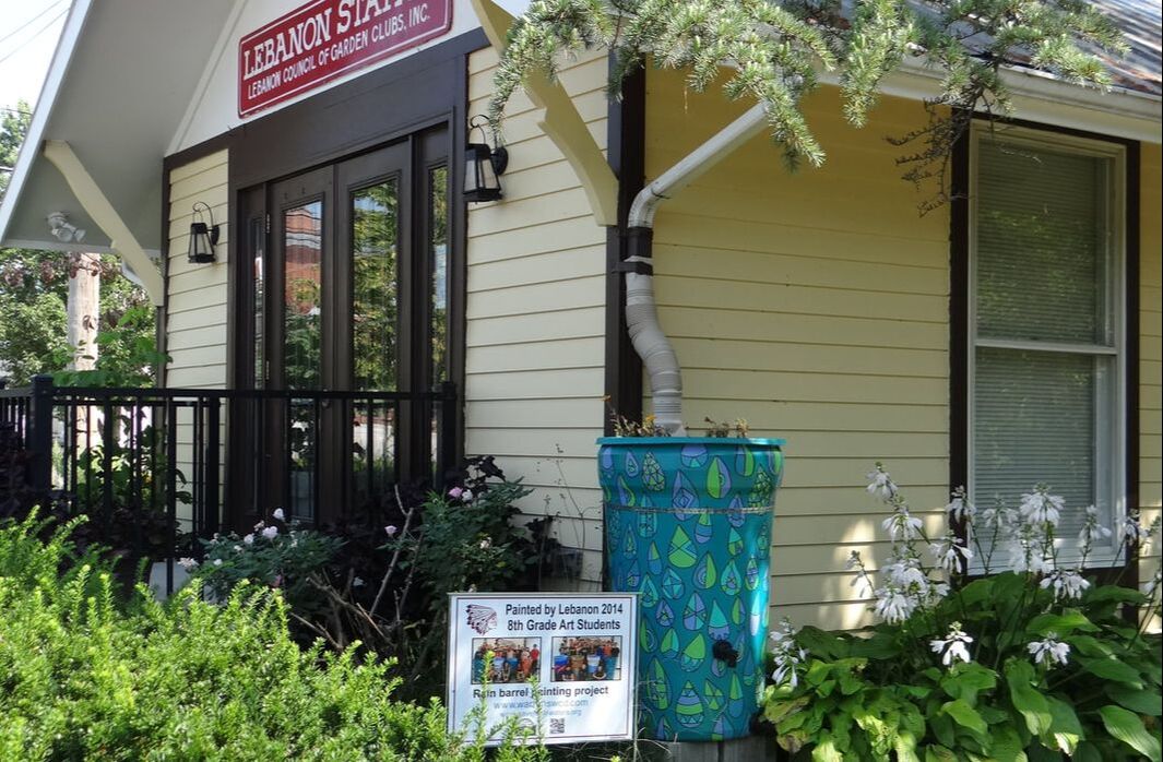 The naming convention alone promotes sustainability—these practices have significantly lower carbon footprints just by the reduction in the amount of material that must be mined/extracted, used in production, and transported to the site where they will be installed. Along with requiring less energy and resources to route stormwater runoff, these practices have aesthetic value and economic benefits. Communities have been able to save money by reducing the diameters of piping by directing flow through a rain garden or an open space to allow for infiltration. A lower flow rate can also lead to less transport of pollutants from urban stormwater runoff and the ability to manage higher volumes during flood events.
More about green infrastructure can be found at: https://www.epa.gov/green-infrastructure/what-green-infrastructure Questions? Call our Urban Team at (513) 695-2901!
2 Comments
Thank you to everyone who attended the first program of our newly relaunched series, Urban Chats. We're grateful to Margaret Minzner, Environmetnal Senior Planner at the Ohio-Kentucky-Indiana Regional Council of Governments (OKI), for sharing her expertise. If you were unable to make it to the program, never fear! You can check out the recording below or on our YouTube channel. If you have any questions, feel free to contact Veronica Buchanan at veronica.buchanan@co.warren.oh.us or Margaret Minzner at MMinzner@oki.org. 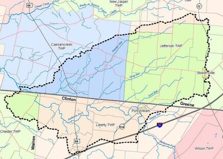 Above: Painters Run-Anderson Fork Above: Painters Run-Anderson Fork What is a watershed?
In the simplest terms, a watershed is an area of land which drains to a central water body such as a river or lake. Also called drainage basins, watersheds range in size from a small retention pond in your neighborhood to the Mississippi River Basin, which transports water from over 30 states to the Gulf of Mexico. Why are watersheds important? Examining our communities and the broader region in terms of watersheds can help us make decisions regarding our personal and professional water use. The earth is covered in water - 96.5% is in the oceans, which cover 70% of the earth’s surface. A tiny fraction of earth’s water, only 1.7%, is found in groundwater, rivers, lakes, wetlands, and soils. Groundwater makes up 30% of all freshwater, which is 35 times more water than all the lakes and rivers combined. So why are we so concerned with surface water if it’s such a small portion of the earth’s tremendous water resource? The United States has over 4.8 million kilometers of rivers, streams, creeks, and brooks. These bodies of water flow through heavily urbanized cities as well as sparsely populated rural areas and pick up sediment, debris, and other pollutants along the way. Our local stormwater sewer systems (MS4s) contribute water to many streams and creeks as well as the Little Miami River and the Ohio River. By actively managing the materials discharged into local waterways we can maintain the health of our regional watersheds, thereby providing clean water for creatures and communities downstream. For more information on watersheds, see the EPA’s Healthy Watersheds Protection FAQ page: https://www.epa.gov/hwp/basic-information-and-answers-frequent-questions Additional Resources: https://www.neefusa.org/nature/water/lesson-1-watershed-basics https://eec.ky.gov/Environmental-Protection/Water/Protection/DocsGuidebook/KY%20Watershed%20Planning%20Guidebook%20-%20Watershed%20Basics.pdf 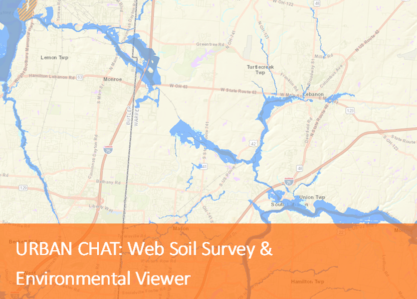 Tuesday, January 25th 12:00pm-1:00pm Join us for an overview of Web Soil Survey and a discussion of Environmental Viewer with Margaret Minzner, Environmental Senior Planner with Ohio Kentucky Indiana Regional Council of Governments. This program is part of a year-long series designed to highlight online databases and tools for development planning. This session is online and registration is required. To register, complete the form below. Questions? Contact Veronica Buchanan at (513) 695-2901 or veronica.buchanan@co.warren.oh.us. To develop within certain jurisdictions located in Warren County, the site owner is required to obtain an Earth Disturbing Permit (EDP) on any project where the proposed disturbed area is greater than one acre. The jurisdictions where our MS4 services are provided, and therefore EDPs issued by Warren Co SWCD, can be found on the Earth Disturbing portion of our website. To complete an application, site owners will need a Stormwater Pollution Prevention Plan (SWP3) prepared along with construction drawings, basin calculations (if applicable), basin operation and maintenance documents, and a completed Earth Disturbing Permit application. A SWP3 template along with the sediment basin compliance tool used for design calculations can be found on the Ohio EPA website. Once the SWP3 has been developed, site owners can apply for a Notice of Intent (NOI) through the Ohio EPA. The NOI permit number is needed on the EDP application. Construction drawings and other related details must also be approved by the engineer overseeing post-construction for a permit to be issued. All documents can be submitted electronically on our website. Once a full application submission has been received, a member of Warren Co SWCD’s Urban Team will send an email receipt and add it to the review queue. After the disturbed acreage has been verified an invoice will be emailed to the point of contact. Warren SWCD will send either an approval or request for additional information within two weeks of receiving the submittal. If you have additional questions on preparing the required documents or the application process, please contact out office at (513) 695-1337. We look forward to helping you with your next project! 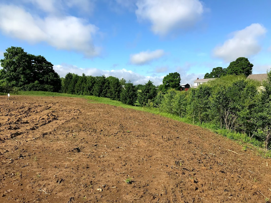 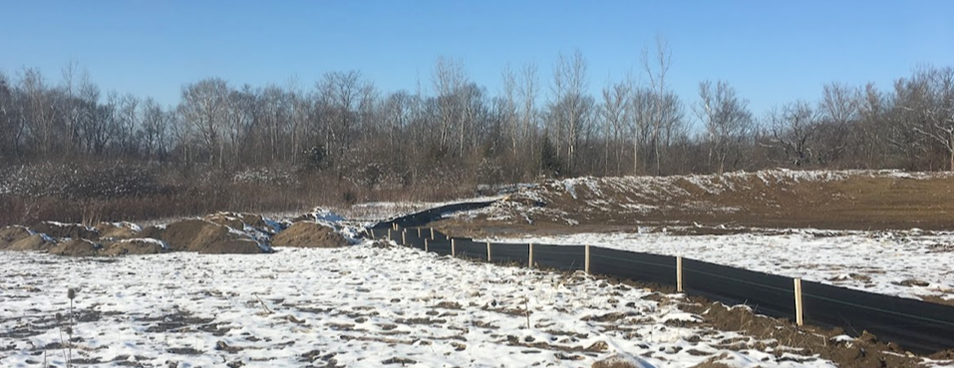 Welcome to Development Digest - a place where Warren Co SWCD shares information, updates, and trainings for professionals in stormwater management, land development, and stream protection.
Winter is quickly approaching in Warren County, and the snowfall that occurs during winter months can result in excessive amounts of soil erosion and transport of sediment into our local waterways. For your construction site to be compliant with Ohio EPA Construction General Permit regulations, workers should begin applying temporary stabilization measures for areas that will be left idle over winter months. For a disturbed site, stabilization techniques are required if areas are to remain dormant for more than 14 days. Preparing the disturbed area for winter conditions by providing cover over bare soil and ensuring proper function of controls will result in minimal environmental impact. For all disturbed sites it is essential to install perimeter and inlet protection so that snowmelt leaving the site passes through a filter prior to discharging into the drainage network. Additionally, it is necessary to install rock check dams and construction entrances prior to the onset of weather to avoid loss of sediment downslope. Other stabilization measure providing cover over a large portion of the site include seeding, mulching, and sodding. The goal is to apply these vegetative treatments by November, but sometimes this is not always practical with varying schedules. To learn more about coverage options, specifications, and seeding schedules, browse through Chapter 7 of the Ohio Rainwater and Land Development Manual. Warren Co SWCD’s expert Urban Team is also available to help – call us at 513-695-2901. |
Urban team BLOGEvery month, the Warren Co SWCD Urban Team dives deep into the world of land development as it relates to stormwater pollution prevention. The blog covers topics like erosion & sediment control best management practices (BMPs), state and local regulations, retention/detention basins, and the conservation of our natural resources. Stay up to date with Development Digest by signing up for WCSWCD Urban eNews!
Categories
All
Archives
April 2024
|
 RSS Feed
|
|
Contact:PHONE: (513) 695 - 1337
EMAIL: wcswcd@gmail.com HOURS: Monday - Friday 7:30am - 4:00pm (except holidays) Connect:Warren County Soil & Water Conservation District Copyright © 2016
Warren SWCD Privacy Notice. Emails are serviced by Constant Contact. Constant Contact's Privacy Notice. |