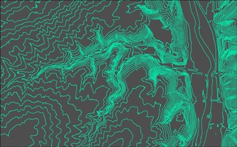
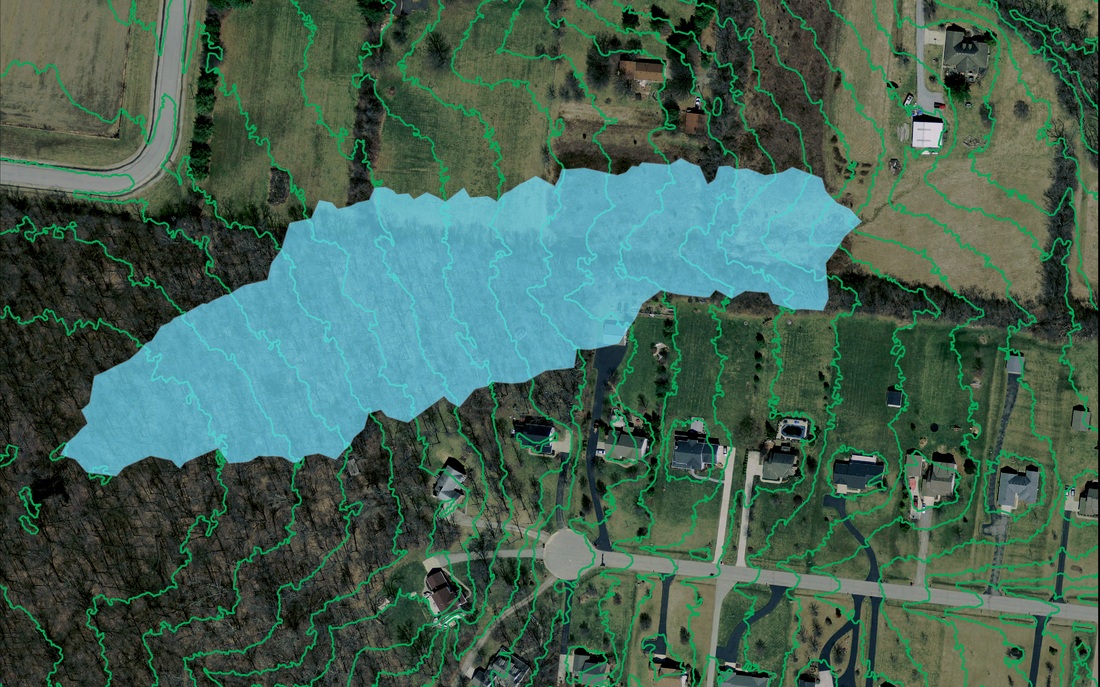
WARREN CO SWCD

gis/Mapping

  • Home
    • About
    • Contact Us
    • Board Supervisors
    • Staff
    • NRCS
    • Employment Opportunities
    • Volunteer Opportunities
  • Upcoming Programs/Events
    • Ag Tour
    • Annual Meeting
    • Introduction to Kayaking
    • Lebanon Oktoberfest
    • Stream Clean Ups
    • Stream Encounters
    • Summer Contests
    • Urban Chat Series
    • Warren Water Striders
    • Women for the Land
    • Partner Events
  • Services
    • EQUIPMENT RENTAL
    • For Residents >
      • Drainage, Erosion & Pond Assistance
      • Soil Testing
      • Water Testing
      • Stormwater Basin Inspections
      • Maps & Historic Aerial Images
      • Backyard Conservation >
        • Ohio Native Plants
        • Pollinator Pathways
        • Rain Gardens
        • Rain Barrels
        • Composting
    • For Agriculture Producers >
      • Nutrient Management
      • Land Preservation
      • Cover Crops
      • GIS/Mapping
      • Caesar Creek Collaborative >
        • Meet the Collaborative
        • Our Work
    • 2024 H2Ohio Program
    • For Businesses >
      • Stormwater Basin Inspections
    • For Municipalities >
      • Illicit Discharge Detection Program
      • Operation Rain Garden Grants
  • PERMITS
    • Earth Disturbing in Warren County >
      • Earth Disturbing Permit Application
    • Floodplain Management >
      • Floodplain Determination Request Form
      • Flood Applications, Forms & Documents
  • Education
    • Programs >
      • Classroom Programs
      • Youth Programs
      • Community Outreach
    • Virtual Classroom
    • Urban Conservation Learning Lab
    • Dagmar the Dragonfly
    • Turtle Education Ambassador
    • Program Loan Portal
    • Scholarship Opportunities
    • HS Envirothon
    • Educator Workshops
  • Blogs
    • Conservation Connection
    • Development Digest
    • Education Connection
Picture

Geolocation Mapping

The Warren SWCD GIS technician can create maps that geolocation any number on natural resources on your property or area of interest. 

Topographic Maps

A topographic map is a detailed and accurate two-dimensional representation of natural and human-made features on the Earth's surface. These maps are used for a number of applications, from camping, hunting, fishing, and hiking to urban planning, resource management, and surveying. The Warren SWCD GIS technician can create topographic maps that depict any number of contour intervals from various topographic sources.
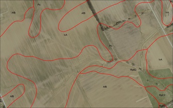
Picture
Picture

watershed delineation maps

Warren SWCD GIS technician has data sources available to create watershed maps.  These maps can identify a watershed's boundaries

soils maps

Warren SWCD has access to numerous soil data layers.  If you need a soils map, contact our GIS technician.
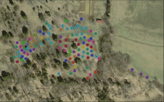
Picture

site survey mapping

Warren SWCD performs some types of surveying work, usually for small drainage projects.  Let us know if you need assistance with your survey mapping needs.
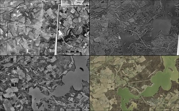
historical aerial maps

Warren SWCD hosts a variety of the County's historical aerial maps.  Come to our office at any time to look through these maps and receive copies.
Picture


Sam Ciaramitaro
SWCD  District GIS Technician

​513-695-2830.
[email protected]
Picture

Contact:

PHONE: (513) 695 - 1337
EMAIL:   [email protected]
HOURS: Monday - Friday 7:30am - 4:00pm (except holidays)

Connect:

Warren County Soil & Water Conservation District Copyright © 2016
Warren SWCD Privacy Notice. Emails are serviced by Constant Contact.  Constant Contact's Privacy Notice.
  • Home
    • About
    • Contact Us
    • Board Supervisors
    • Staff
    • NRCS
    • Employment Opportunities
    • Volunteer Opportunities
  • Upcoming Programs/Events
    • Ag Tour
    • Annual Meeting
    • Introduction to Kayaking
    • Lebanon Oktoberfest
    • Stream Clean Ups
    • Stream Encounters
    • Summer Contests
    • Urban Chat Series
    • Warren Water Striders
    • Women for the Land
    • Partner Events
  • Services
    • EQUIPMENT RENTAL
    • For Residents >
      • Drainage, Erosion & Pond Assistance
      • Soil Testing
      • Water Testing
      • Stormwater Basin Inspections
      • Maps & Historic Aerial Images
      • Backyard Conservation >
        • Ohio Native Plants
        • Pollinator Pathways
        • Rain Gardens
        • Rain Barrels
        • Composting
    • For Agriculture Producers >
      • Nutrient Management
      • Land Preservation
      • Cover Crops
      • GIS/Mapping
      • Caesar Creek Collaborative >
        • Meet the Collaborative
        • Our Work
    • 2024 H2Ohio Program
    • For Businesses >
      • Stormwater Basin Inspections
    • For Municipalities >
      • Illicit Discharge Detection Program
      • Operation Rain Garden Grants
  • PERMITS
    • Earth Disturbing in Warren County >
      • Earth Disturbing Permit Application
    • Floodplain Management >
      • Floodplain Determination Request Form
      • Flood Applications, Forms & Documents
  • Education
    • Programs >
      • Classroom Programs
      • Youth Programs
      • Community Outreach
    • Virtual Classroom
    • Urban Conservation Learning Lab
    • Dagmar the Dragonfly
    • Turtle Education Ambassador
    • Program Loan Portal
    • Scholarship Opportunities
    • HS Envirothon
    • Educator Workshops
  • Blogs
    • Conservation Connection
    • Development Digest
    • Education Connection